Donegal County Council and Esri Ireland have published an online dashboard charting information about the spread of Covid-19 on both sides of the border.
The dashboard, which was developed in Donegal, combines data from the Department of Health and Public Health Northern Ireland, the hub is updated daily and provides information on confirmed cases such as age profile, transmission cause, number of infected healthcare workers and more.
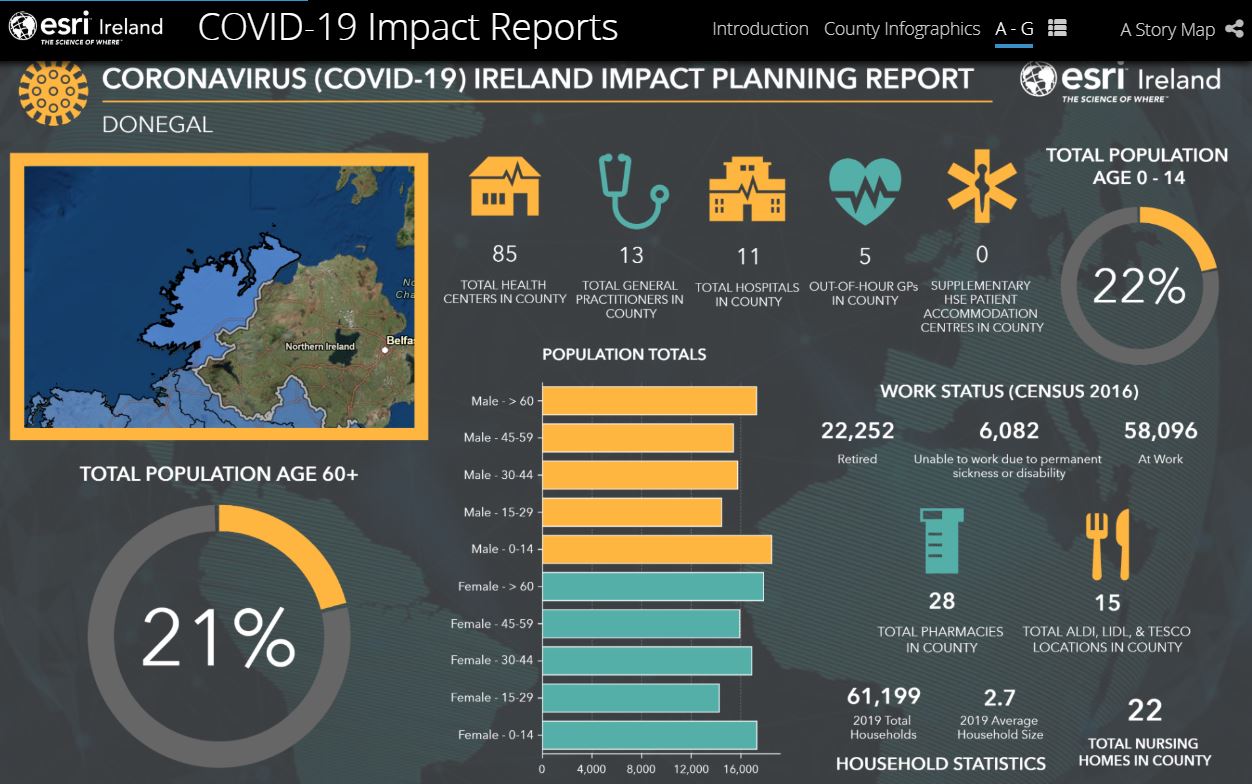
Esri Ireland has also compiled infographics for every county in Ireland – including Donegal – on their preparedness for coronavirus.
Dermot O’Kane is sales manager with Esri Ireland………
******************************
Press release in full –
New online dashboard provides maps and data for COVID-19 cases across Ireland
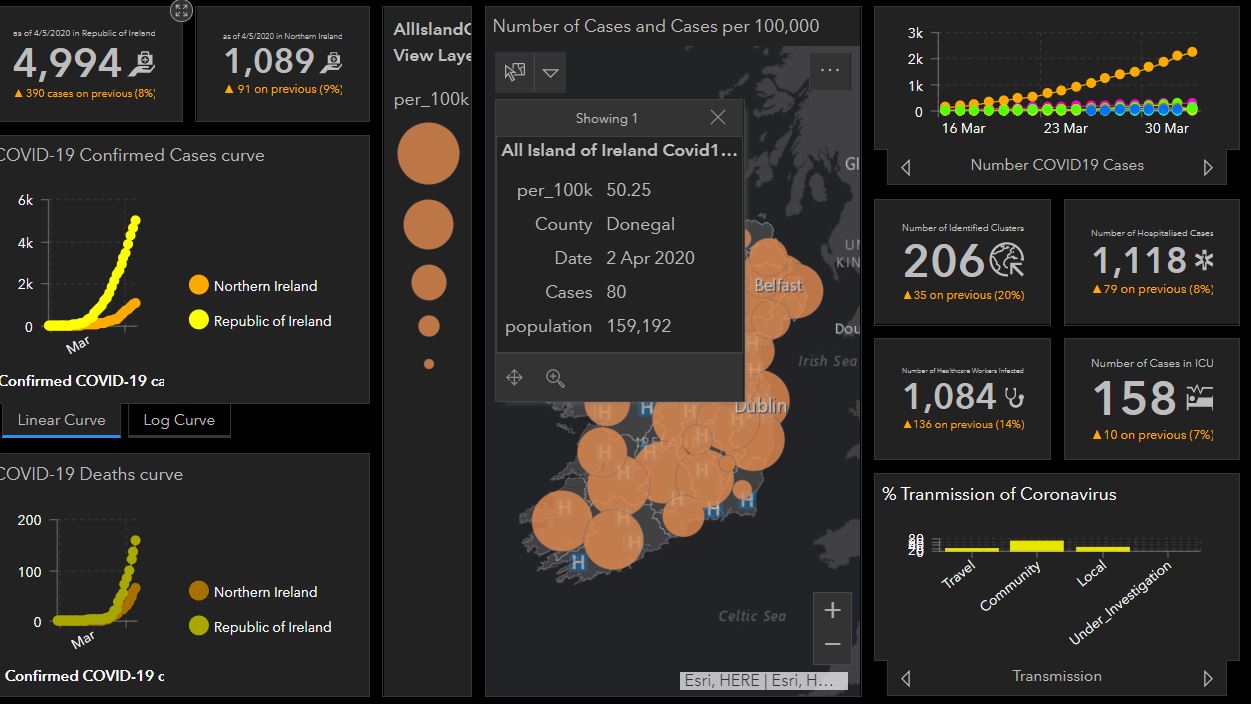
- Free online dashboard created by Donegal County Council maps and charts confirmed cases throughout the island of Ireland
- All data compiled from the Department of Health and Public Health Northern Ireland
- Data on age profile, transmission cause, number of infected healthcare workers and more all updated daily
Dublin, 6th April 2020 – Esri Ireland, the market leader in Geographic Information Systems (GIS), today announces that Donegal County Council has used its digital mapping platform to create a comprehensive COVID-19 dashboard with information on confirmed cases across the island of Ireland. The freely available online dashboard is updated daily and compiles data from the Department of Health and Public Health Northern Ireland.
The dashboard helps users to visualise data related to the outbreak of COVID-19 throughout the Republic of Ireland and Northern Ireland. Confirmed cases and data can be filtered for analysis by county and district. Charts and graphs on confirmed cases and deaths, as well as breakdowns of age groups, gender and transmission type can all be viewed clearly.
Percentage and actual increases in figures, including the number of healthcare workers infected and number of cases in ICU, can be tracked via the dashboard on a day-to-day basis. Links to official guidelines and information from the HSE, Department of Health, Public Health Northern Ireland and World Health Organisation are also available on the platform.
The dashboard can be viewed at: bit.ly/COVID19-All-Island
Additionally, Esri Ireland has made available COVID-19 Impact Planning infographics for every county in Ireland. The infographics detail the preparedness of each county for coronavirus, by outlining population breakdowns, work status of population and total numbers of healthcare facilities in the county, such as health centres, hospitals and GPs. Detailed infographics for every county in Ireland are available to view at: https://arcg.is/jmr1C.
Podcast: Play in new window | Download


