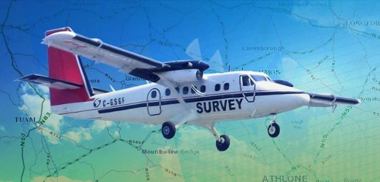
The Geological Survey of Ireland is preparing for the next phase of the ‘Tellus’ project, which will see a low flying plane using specialist equipment to collect geophysical and geochemical data on rocks, soil and water on the ground in Donegal.
The geological mapping project has now been completed in parts of the West, with data to be released in the coming weeks. Flights over Donegal and Mayo begin in early March, with the specially equipped plane flying at a height of 60 metres.
Tellus say the data will assist in understanding the local environment, soil management and natural resource potential for these counties.
They’re also urging farmers to be aware of the risk of the low flying plane worrying horses and other animals, and specific details of flight plans will be released in the coming days.
Koen Verbruggen of the GSI says it’s an important initiative…….
Podcast: Play in new window | Download


")